Using digital tools and methodologies to solve engineering problems, working at the forefront of technology to add value and efficiencies to our projects and customers.
Digital Engineering can be seen in many lights. It can be a powerful enabling tool to unlock new insights into construction methodologies and best practices or it can be used to prove the viability of prospective projects at tender and anywhere in between.
We offer a wide range of services, catering to all requirements throughout the project lifecycle. Our team has a broad understanding of engineering principles and deploy digital tools to develop solutions enhancing efficiencies and solving engineering problems.
The team has unparalleled experience in virtual design and construction, BIM, GIS, drone operations and data capture. We aim to tailor a bespoke solution to our project’s and customer’s requirements, whilst working to embed business as usual best practices, continuously building our client’s digital maturity.
For more information please contact digital@taylorwoodrow.com or matthew.hyett@taylorwoodrow.com

Digital Engineering Capabilities
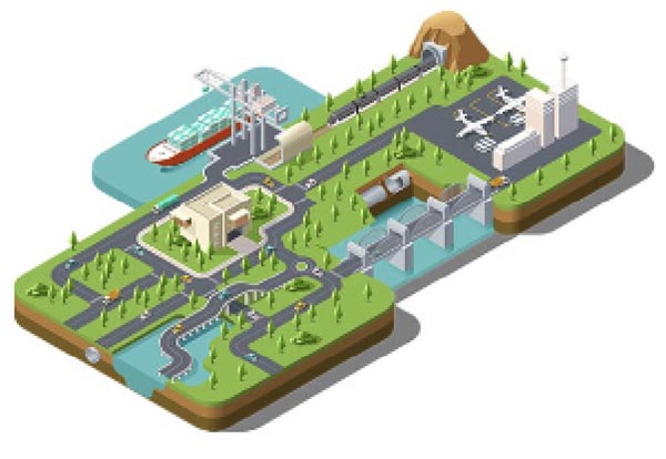
Our extensive portfolio of capabilities will ensure we meet the needs of our clients across rail, highways, airports and energy sectors.
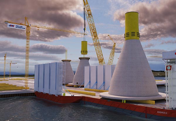
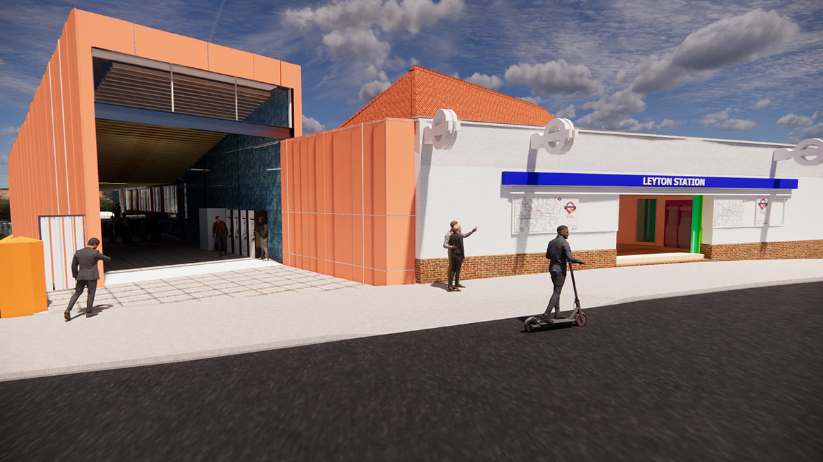
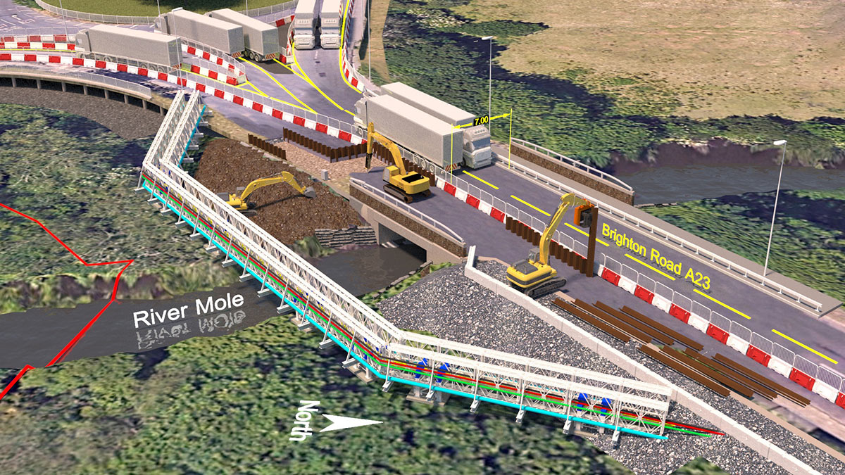
Tender and concept design visualisations
GIS services
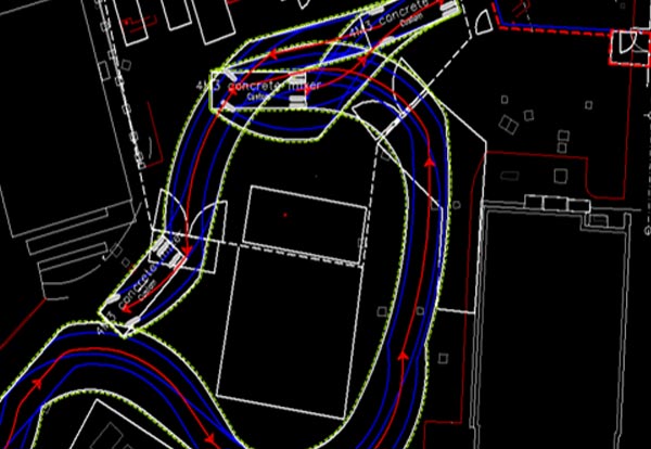
Swept path analysis
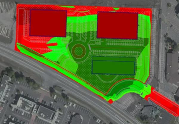
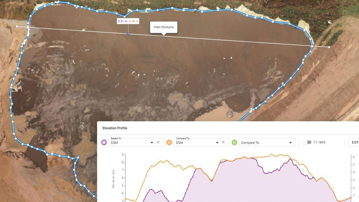
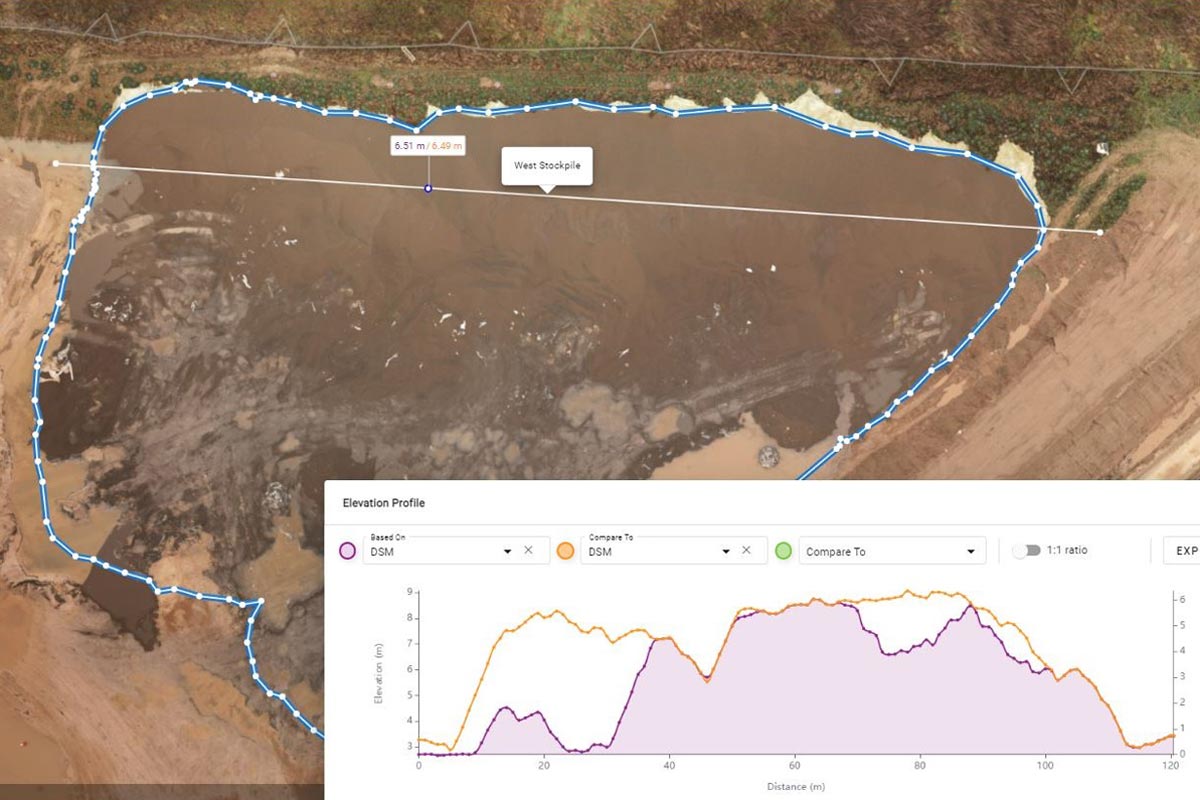
Cut and fill analysis
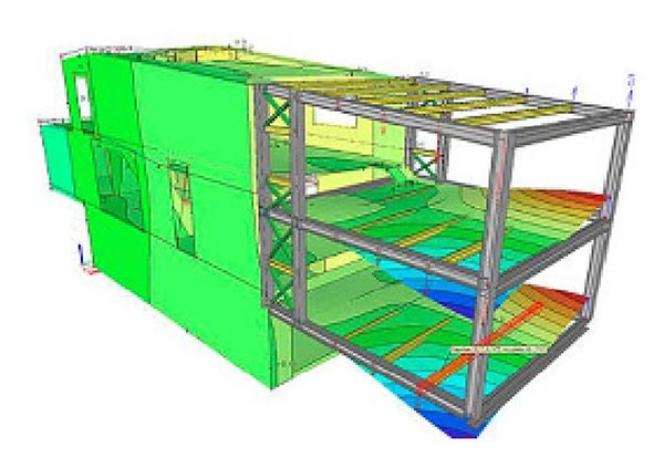
BIM services
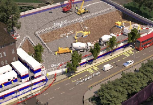
Logistics analysis
Best practice for digital and design management/delivery
Digital validation and co-ordination

Training delivery
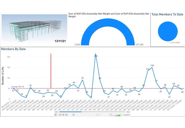
Digital process tracking
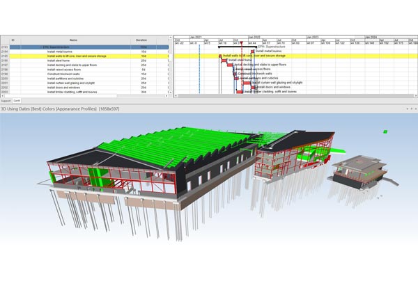
4D/4D services
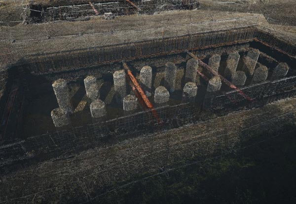
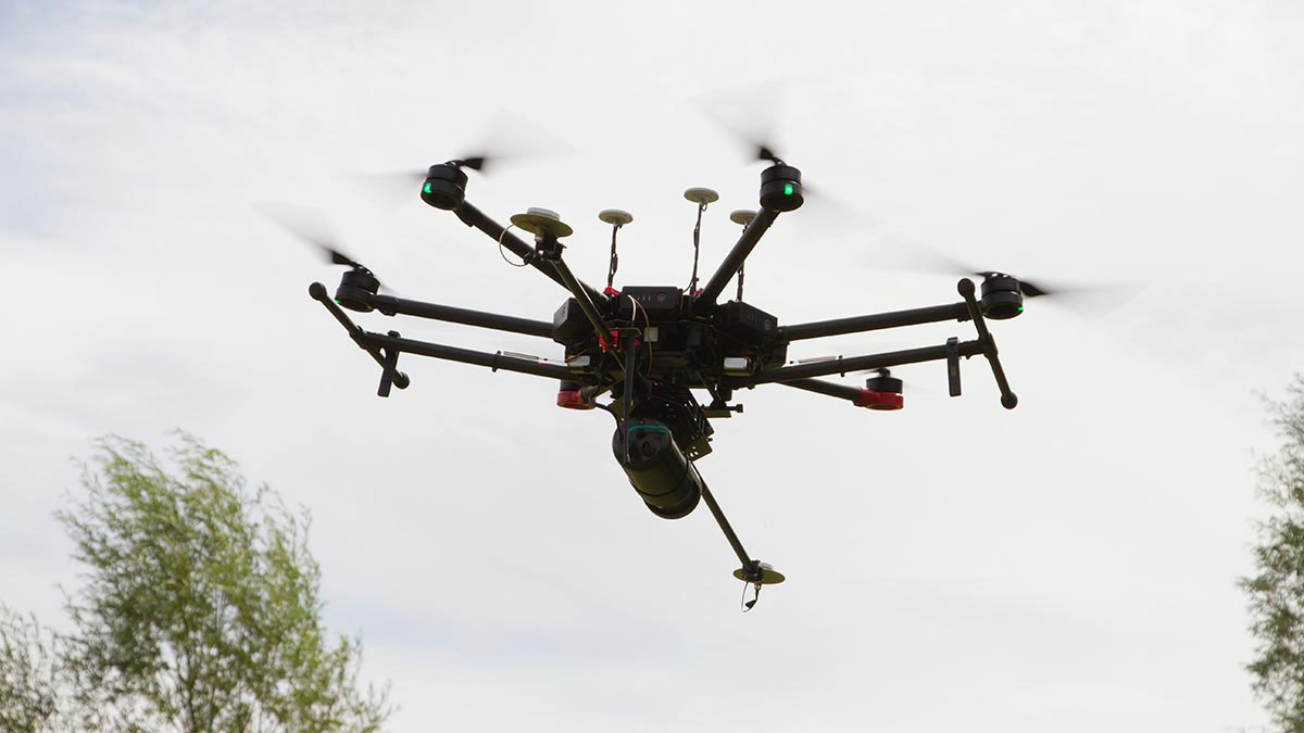
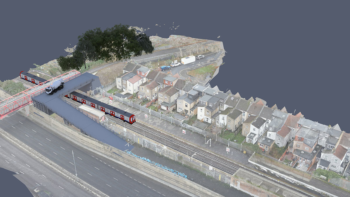
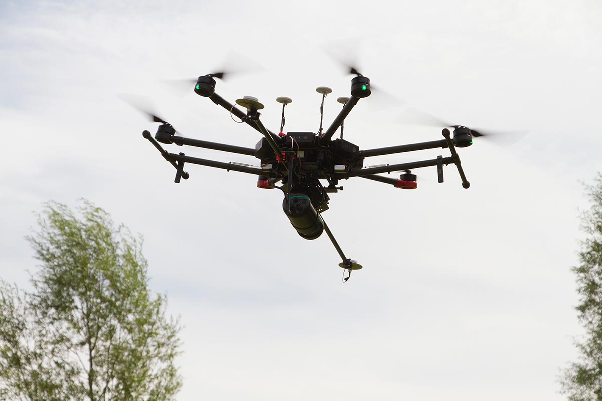
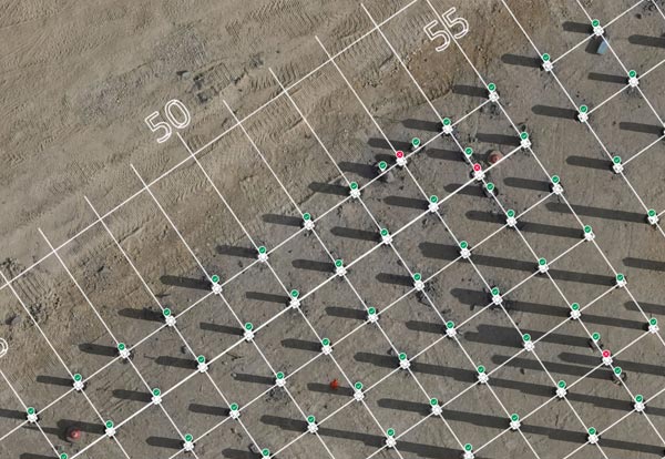
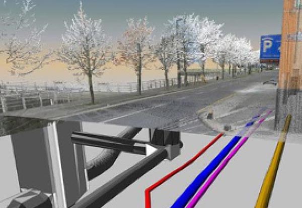
Data capture
Services overview:
- Aerial Data Capture / Photogrammetry
- Terrestrial Laser Scanning
- Confined Space Mapping
- Aerial Photography
- General Inspections/reports of structures using UAV
- Aerial LiDAR / Topography
- 360 Data Capture
- Underground Services Mapping (AVUS)
- 4D Services
- Phasing/methodology Images
- Digital Progress Tracking
- Virtual Reality Solutions
- AR for underground features
- Clash Detection of 3D models
- Quantity Take Offs
- Cut and Fill Analysis
- Stockpile analysis and tracking
- 2D drawing production
- Swept Path Analysis
- 3D Modelling Production
- General Data Processing and viewer software platform management/administration
- BIM management and requirements reviewing
- GIS management, geodatabase creation for asset information
- Stakeholder engagement with clients, schools and delivering various presentations
- Training delivery
- Digital Consultancy Service